Search
Use keywords to search across notebook descriptions

Use keywords to search across notebook descriptions
3 Paternoster Row; 228 Hanbury Street; 15 Fort Street; 104 Rothchilds Buildings.
28 King Edward Street: 2 White's Row; 52 Chicksand Street; Booth Street Buildings; 1 Parliament Court; 28 Heneage Street
19 Mullen Court; 48 Durrand Street; Brunswick Buildings; 39 Queen Anne Street; 8 Mundy's Place; Old Montague Street; 7 Warwick Court; 3 Rupert Street.
86 Old Montague Street; 28 Finch Street; Bath Gardens House; 11 Newcastle Place; 76 High Street; 49 Church Street.
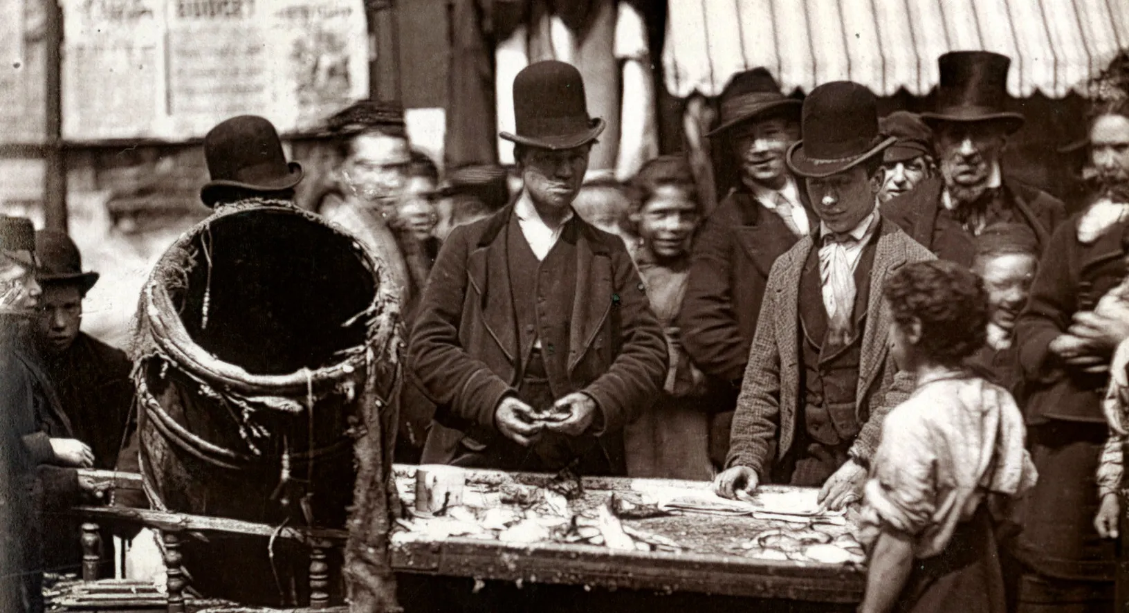
Sketch of ground floor plan of house found in many of the courts and alleys in Whitechapel.
Summary of housing and rents in Whitechapel: model dwellings; typical rents; Jews and overcrowding; main employment as tailors.
Extracts from the Relieving Officer's records concerning the houses and rents of specific properties. Contains information on tenants including the number and ages of children. A list of the proper...
Notes on Whitechapel registration district: sub-registrations districts of Spitalfields; Mile End New Town; Whitechapel Church and Goodman's Fields; Jewish community and overcrowding; main industri...
Ogilby Street; Lower Wood Street; Robert Street; 92 King Street; 34 Charles Street
Summary of housing and rents in Woolwich: types of houses; typical rents; improvement in area; main employment; healthy and little overcrowding.
Notes on Woolwich: types of housing; typical rents; sketch of ground floor plan of poorer houses in Woolwich; demolitions of poor houses; main employment at the dockyard and the arsenal; main women...
1897 George H.Duckworth's Notebook: Police District 11 [Poplar and Limehouse], District 12 [Bow and Bromley] and District 13 [South Hackney and Hackney]
Preston Road, East India Dock Road, Bow Road
Children playing games in the street on Chusan Place, street market in Salamans Lane. Chusan Place, St Anne's Street, Salmons Lane.
At the corner of Manchester Road and Glengall Road is situated a co - operative public house. Blackwall tunnel works. Glengall Road, Manchester Road, Brunswick Street; Prestons Road, Leicester Stre...
Farnham Street [Parnham St on underlay map], John's Gardens.
Many of the inhabitants of Carr Street, are haddock curers. Dupont Street, Carr Street, Maroon Street, Eastfield Street, North Street, Elsa Street, Donkey Row, Manning Street, Halley Street.
Prestage Street, Naval Row, Orchard Street, Orchard Place, East India Dock Road, Robin Hood Lane, Cotton Street.
East India Dock Road, Aberfeldy Street, West India Dock Road.
West India Dock Road, Poplar High Street.
Ashton Street, Manisty Street, Wells. Street, East India Dock Road, Union Street, Osborne Place Court, Providence Place, Cotton Street, Bow Lane, Montague Place, Newby Place, Grove Villas Bath Vill...
Boundaries of the walk: on the north Gainsborough Road; on the east by the Hackney cut; on the south by the Hertford Union Canal; on the west by the North London Railway [St Mary of Eton and St Mar...
Osborne Road, Daintry Street, Mallard Street, Chapman Road, Felsted Street, Victoria Road.
Montague Terrace, Felstead Road, Chapman Road, Prince Edward Road