Search
Use keywords to search across notebook descriptions

Use keywords to search across notebook descriptions
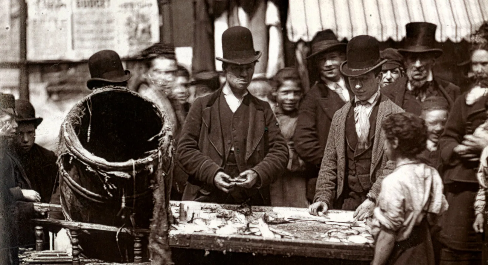
Prices at Whitecross Street market. Errol Street, Belward Avenue, Whitecross Street, Blythe Yard.
Cumming Street, Rodney Street, Henry Street, Cynhtia Street, Hermes Street, Providence Place.
Penton Street, Godson Street, Rising Hill Street, Hermes Hill, Penton Houses.
Police and convicts. Additional streets mentioned in the walk:
Description of boundaries of walk: on the north Regents Canal and Wynford Road; on the east Penton Street; on the south by the north boundary of police division N; on the west York Road. Part of th...
Caledonian Road, Albion Street, Caledonia Street, Netherton Place, Railway Street.
Wharfdale Road, Crinan Road, York Road, Wharfdale Road, North Street, Lavina Grove, New Wharf Road.
All Saints Street, Winchester Street, Picton Yard, Caledonian Road, Southern Street, Southampton Street, George Street, Cumming Street, Wynford Road, Little Cumming Street.
Prostitution in the area. Children and alcohol. Additional streets mentioned in the walk: Wynford Road, Rodney Place, Joys Buildings, William Street.
Drinking increasing amongst women and decreasing amongst men.
Drinking amongst children. Opinion of children fetching beer for their parents
Three King Court, Elizabeth Place, Withers Place, Royley Street, Beckford Square, Tilney Court.
Gambling in the area. Brothels in the area.
Procedures for ex-convicts. Information on Notting Dale.
Emigration due to demolition of buildings and removal of inhabitants.
Payments by publicans to police. Police relationships with working classes
General remarks on the district. Hours of duty of the police
Description of boundaries of walk: on the north Elm Street, Mount Pleasant; on the east Farringdon Road; on the south Clerkenwell Road; on the west Gray's Inn Road. Part of the parishes of Holy Tri...
laystall Street, Roseberry Avenue, Poole's Buildings, Warner Street, Bath Court, Coldbath Square, Roseberry Avenue.
Italians and thieves are inhabitants of Mount Pleasant and Kemp Place. Mount Pleasant, Baker's Row, Bath Row, Crawford's Passage, Crawford Place, Kemp's Place.
Caroline Place, Providence Place, Warner Street, Ray Street, Farringdon Road, Little Saffron Hill.
The Italian quarter. Additional streets mentioned in the walk: Leister Place, St. Peter's Terrace, Back Hill, Summer's Place, Eyre Street Hill, Eyre Place.
Eyre Terrace, Fleet Row, Eyre Court, Vine Street, Clerkenwell Road.
Description of boundaries of walk: on the north Clerkenwell Road; on the east Farringdon Road; on the south High Holborn; on the west Leather Lane. Part of the parish of St Peter's Holborn. Hatton ...
Brothel on Great Saffron Hill. Saffron Court, Castle Street, Onslow Street, Great Saffron Hill, Charles Street, Bleeding Hart Yard, Kirty Street, Cross Street.
Viaduct Buildings, Ely Place, Hatton Garden, Bull Inn Chambers, Leather Lane.
Numbers of police in the sub-division. Additional streets mentioned in the walk:
Leather Lane market and Prudential Assurance Company building. Additional streets mentioned in the walk: Robin Hood Yard, Leather Lane Buildings, Cross Street, Hatton Wall.
Description of boundaries of the walk: on the north Old Street; on the east Whitecross Street; on the south Chiswell Street, Beech Street; on the west Goswell Road. Part of the parishes of St Thoma...
Description of Whitecross Street market. Whitecross Street, Whites Yard, Banner Street, Peabody Buildings, Warwick Place.
Playhouse Yard, Shrewsbury Court, Red Lion Market, Whitecross Street Chambers, Angel and Porter Yard, Lensden Place.
Playhouse Yard, Rose Court, Baltic Street, Honduras Street, Norway Street, Domingo Street [some names display better on modern underlay map].
Memel Street, Middle Row, Sycamore Street, Thomas' Place, New Court [some names display better on modern underlay map].
Baltic Place, Baltic Court, Hatfield Street, Deans Court.
French Alley, Bayer Street, New Court, Little Arthur Street, Osman's Place, Great Arthur Street, Great Arthur Street.
General remarks on district " An airless poverty stricken and vicious looking neighbourhood" Additional streets mentioned in the walk: Fann Street, Hot Water Court, Saddlers Buildings.
Sketch map of walk. Old Street, City Road.
Description of the boundaries of the walk: on the north and east City Road; on the south Old Street; on the west Central Street. Part of the parishes of St Clement's City Road, St Luke's Old Street...
Norman Buildings, Paton Street Langton Street, Langton Avenue, Clarence Place, Garden Row.