Search
Use keywords to search across notebook descriptions

Use keywords to search across notebook descriptions
Poor streets in district are identified. Additional streets in this walk: Mildmay Road, Stoke Newington High Street, Mildmay Grove, Ball's Pond Road.
Description of the character of publicans.
Detmold Road, Inver Road, Mundford Road, Dudlington Road, Middlesex Street, Beecholme Road, Prout Road, Casimer Terrace, [Casimer Terrace], Brooke Road, Ickburgh [Road]
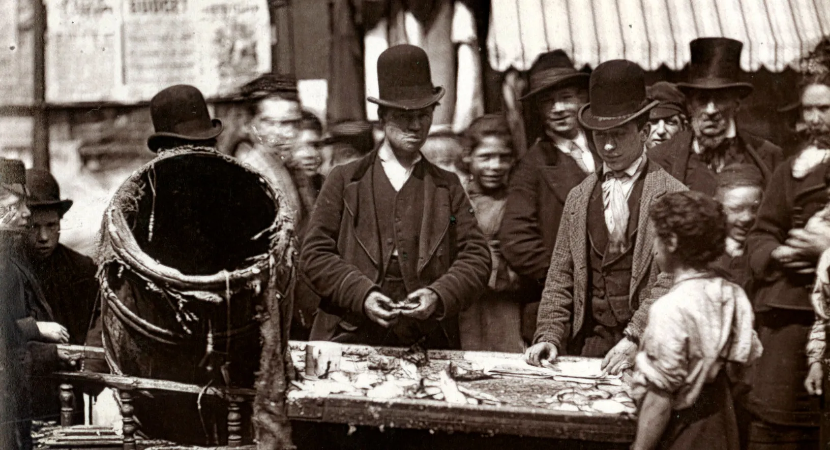
Children fetching beer from public houses.
Superintendent Weston's opinion of Inspector James Flanagan.
Sketch map of the Dalston sub-division of the J Division.
Description of the boundaries of the Dalston sub-division of the J Division: on the south by the Regents Canal; on the west Southgate Road, Church Road, Essex Road, St Pauls Road, Wallace Road, and...
Brooke Road, Clapton Road, Evering Road, Walsingham Road, Kenninghall Road, London Road, Cross Road, Avenue Road, Oakfield Road, Nightingale Road, Love Lane, Ferron Road, Charnock Road, Heyworth Road
Children sent to the public houses to fetch beer
Description of the variations of policeman's beats.
Downs Road, Queen's Down Road, Powell Road, Cricketfield Road, Clarence Road, Thistlewaite Road.
Boundaries of Hackney police sub-division: on the south Cambridge Heath Bridge, Andrews Road; on the east Broadway, along centre path of London Fields, to Fieldview and Greenwood Road, Dalston Lane...
Newick Road, Lower Clapton Road, Atherden Road, Laura Place, Portland Place.
Police accepting drinks from publicans. Women drinking alcohol.
The relationship of the police and publicans.
Clapton Passage, Clapton Square, Portland Place, Clarence Terrace, [Clarence Mews] Clarence Road, Orchard Place, Pembury Grove, Pembury Road.
Description of the boundaries of the walk: on the north Church Road; on the east Rectory Road; on the south Arcola Street, Barrett Grove; on the west Nevill Road, Palatine Road and Stoke Newington ...
Evering Road, Rectory Road, Sydner Road, Foulden Road, Farleigh Road.
Amhurst Road, Stoke Newington High Street, Wellington Road, Somerford Grove.
Stoke Newington High Street, Palatine Road, Prince George Road, Wiesbaden Road.
Many Jews of the lower class living in Prince George's Street, Princess May Road.
Princess May Road, Arcola Street, Dunn Street, Middle Street, Hindle Street.
Shacklewell Road, Shacklewell Row, Seal Street, Perch Street, April Street, Barrett Grove, Cressington Road.
Explanation of colours on map of licensed houses Additional streets mentioned in the walk:
Bodney Road, Andre Road, [Anton Road], Amhurst Road, Manor Place, Brett, Kenmure Avenue, Aspland Grove, Mare Street
General remarks on the district. Additional streets mentioned in the walk: Clapton Road, Dalston Lane.
Description of walk: on the north Dalston Lane, Amhurst Road; on the east Mare Street, Hackney; on the south West Street; on the west Lansdowne Road, Greenwood Road [St Philip Dalston, St Bartholom...
Information concerning the British Xylonite Factory, Homerton High Street. Urswick Road, Mehatabel Road, Link Street, Homerton High Street.
Casterton Street, Pigwell Path, Grove Mews, Grove Passage
Florefield Road, Tower Street, Ellingfort [Road], London Lane, Mentmore Terrace.
Gransden Avenue, Fortescue Avenue, Lamb Lane, Sidworth Street, Bayford Street, Helmsley Street, Helmsley Place, Helmsley Terrace, Exmouth Place, Warburton Road, Triangle Road, Triangle Place.
Rents in Warbarton Street, West Street, London Place. Triangle Road, Triangle Place, Warburton Street, [Warburton Road], West Street, London Place, Twemlow Terrace.
London Fields Terrace, Richmond Road, Wilton Road, Navarino Road, Navarino Grove, Dalston Lane, Spurstowe Terrace, Cottrill Road, Manor Place.
Cottrill Road, Manor Place. Graham Road, Bywell Path, [Grove Mews] Florefield Row, Richmond Road, Richmond Row, Warburton Street, Gayhurst Road, Blackstone Street, [Blackstone Road]