Search
Use keywords to search across notebook descriptions

Use keywords to search across notebook descriptions
c1886 Notebook: St George's-in-the-East. School Board Visitors, Mr Orine (District H), Mr Robinson (District L)
1898-1899 George H. Duckworth's Notebook: Police and Publican District 7 [Mile End Old Town and Spitalfields], District 8 [Aldgate, St George's in the East, Shadwell], District 9 [Bethnal Green, No...
Index of interviews, section and sub-division and nature of interview.
Streets where Jewish community are living in the district. Richardson Street, Wolsey Street, Newark Street, Bedford Street, Ford Square, Rutland Street, Sidney Square, Jubilee Street, Bromehead Road.
Newbold Street, Garden Street [Gardom Street?], Bromehead Street, Nelson Street, John's Place, Baker Street, Bedford Street.
Russian and Polish Jews on Bedford Street Additional streets mentioned in the walk:
Description of boundaries of walk: on the north Whitechapel Road; on the east Bedford Street; on the south Commercial Road; on the west New Road. Part of the parishes of St Philip and St Mary, Step...
Mildmay Medical Mission. Jews living in Rutland Street, Newark Street, Turner Street, Mount Street. The cost of building the Church of St Philip's. Rutland Street, Newark Street, Oxford Street, Tur...
Bethnal Green police force. Park Street, Globe Road.
Jews living in Cotton Street. East Mount Street, Raven Row, Cotton Street, Goakleys Buildings, Nelson Street.
Comparison of Hackney and Bethnal Green parishes. How the parish in Bethnal Green was divided up for visiting purposes
Success of clergy in working class area is to work hard.
The look of convicts. Alderman Evans used to have factories in Royston Street area. He relocated to Essex as a result there has been a migration of weavers to Essex.
The work of the Salvation Army in Bethnal Green. The worst streets in Bethnal Green
Overcrowding in "Buildings" Reverend Lawley's opinion of weavers.
Attitude of women to visiting public houses in Hackney. Prostitution and inter-marrying in Bethnal Green.
Description of boundaries of walk: on the north Ben Jonson's Road; on the east Regents' Canal; on the south Commercial Road East; on the west Whitehorse Street. Part of the parishes of St Dunstan's...
Donkey Row [local slang for Carr Street].
Hope Place, Taylors Place, Ben Jonson Road, Halley Street, Providence Place, Carr Street.
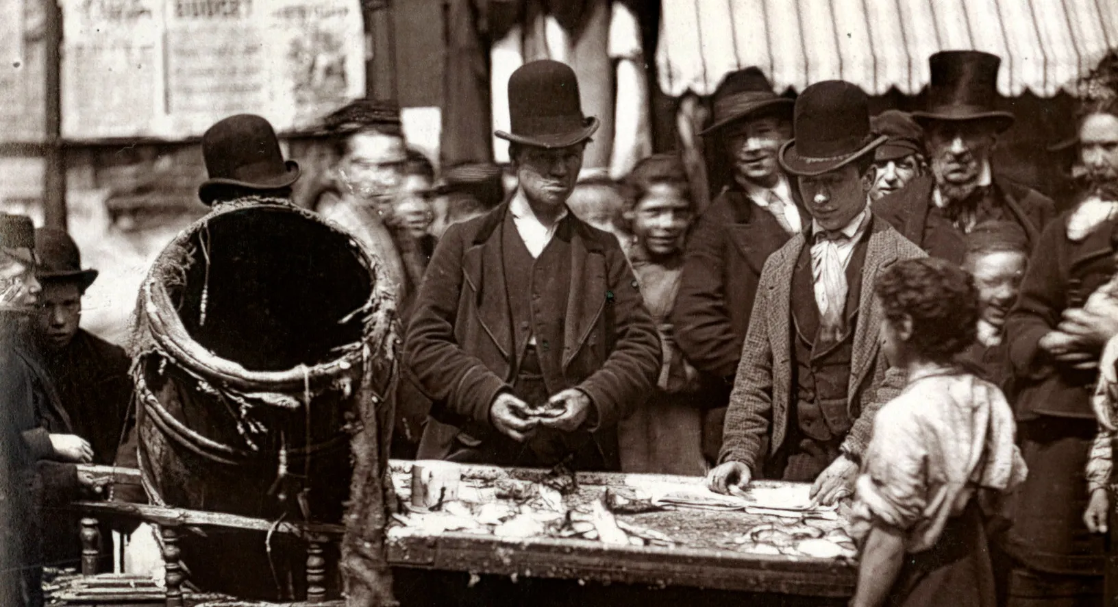
A lot of fish curers east of Carr Street. Elsa Street, Eastfield Street.
Jew buying houses in Reform Place. May's Place, Union Terrace, Beard's Place, Reform Place, Maroon Street, Dupont Street.
Some Irish live in Regent's Court. Blount Street, Brenton Street, Samuel Street, Conder Street, York Place, Aston Street, Cayley Street, John's Gardens, Regent's Court, Salmons Lane, Matlock Street.
Barnes Street, Chaseley Street, York Square, York Road, Raby Street, Wrights Buildings, Railway Place, Bruntons Cottages.
Amusements of the district are boxing and bird singing contests. Street games for girls are battledore and shuttlecock. Additional streets mentioned in the walk: Bruntons Place, Brunton Street.
Description of the boundaries of the walk: on the north Commercial Road; on the east Horseferry Road; on the south by the river Thames; on the west Labour in Vain Road and Hardinge Street. Part of ...
Description of James Place. Havering Street, Ann Street, Bower Street, Stepney Causeway, Hilton Street, James Place.
Description of Cosh's Buildings. Brook Street, School House Street, Collingwood Street, Warton Place.
Causeway Court, Three Compasss Court, Beachcroft, Caroline Street, Brunswick Street, Dorset Street, Susannah Row, Elizabeth Place, Little John Street, Hilton Street.
[Slum]clearances. Ratcliffe Square, Periwinkle Street, Manor Court, Giles Place, Black Ball Court, Grove Court, Ball's Buildings, George Street.
Butcher Row, Medland Street, London Street, Rose Lane, Narrow Street.
The Orchard. Painters Rents, The Orchard, Collingwood Street.
A thieves den at the corner of Collingwood Street and Broad Street. Broad Street, Love Lane, Elm Row, Charles' Place, Shadwell High Street.
[Slum]clearances in Lower Shadwell and the fish market. Market Hill, Monmouth Street, Hopes Hill [i.e. Pope's Hill?].